Overview

The arid landscape of the NSW Far West supports a brilliant array of native species and contains 30,000-year-old Indigenous rock carvings.


Far West region map

Water for the environment

Children playing by the Murray River

98,300km2

Murray and Lower Darling valleys area

The management of environmental water in the Murray and Lower Darling valleys is critical to the ongoing health of a diverse range of ecological communities which include the world’s largest stand of River Red Gum and a 1700km stretch of Australia’s longest river.

Murray and Lower Darling profile

Lachlan wetlands Willandra Creek

98,300km2

Lachlan valley area

The Lachlan River experiences highly variable flows. We work with Lachlan Riverine Working Group to manage the delivery of environmental water when and where conditions allow to provide feeding and breeding habitat for a range of wildlife.


Lachlan Valley profile

Featured threatened species

Common name
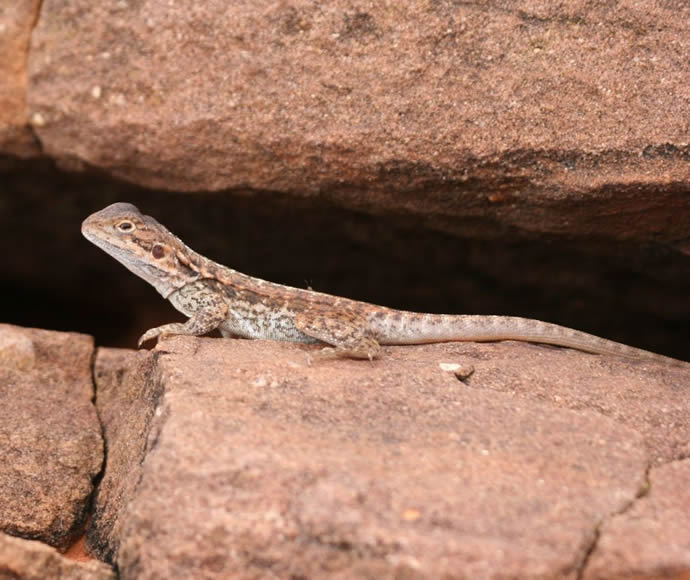
Barrier Range Dragon

Scientific name
Ctenophorus mirrityana

Status in NSW
Endangered

Commonwealth status
Not listed

Males are grey or grey-brown with cream to orange spots on the sides of the neck. Females are less colourful. Up to 220mm in total length.


Climate change

Mean temperatures are projected to rise by 2.1 ÂșC by 2070. The greatest increases are occurring in the north west of the region, around Bourke during summer. All models show there are no declines in mean temperatures across the Far West by 2070.